


Highways England heads underground to test conditions for A12 improvements

Work is underway to test the ground conditions under the A12 in Essex to pave the way for major improvements that are being planned for the route.
The Highways England-led team in charge of the upgrade are investigating at 423 sites along the 15-mile route between Chelmsford and Marks Tey.
The proposals will add an extra lane to the A12 in each direction and save eight minutes on the 83,000 journeys made on the road every day. The ground surveys being carried out now will help to develop the proposals by giving engineers a clearer picture of the type of soils, rock and groundwater beneath the broad area of the proposed new road, while also allowing them to plan how their designs will improve the existing A12.
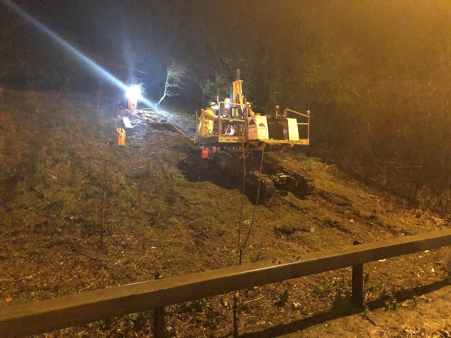
Caption: ground investigations and surveys taking place along the A12 in Essex
Stephen Elderkin, Project Director for the A12 upgrade, said:
"The upgraded A12 will improve capacity on this vital link between London and the East of England, while also improving safety on what is often a congested stretch of road. The complex programme of tests and surveys we’re undertaking will enable us to better understand the ground conditions, and help us build the road safely and in a way that protects the environment, while keeping costs down.
“You can expect to see survey vehicles and equipment in operation on and close to the A12. This is not the start of any construction work: the survey findings will help us develop our road designs, including junctions and structures. Instead, this preliminary work will help us to give the clearest possible picture of what will be involved in upgrading the road when we apply for planning consent in 2021, and help ensure our construction programme can get the new road open for 2028.
"Our priority right now is to carry out the ground investigations and surveys in a way that will have the smallest possible impact on the environment and nearby communities. Most of the work will take place overnight on the existing road, though many of our survey locations will not be visible to drivers. We will look to minimise disruption to residents by keeping the noise of our works down.”
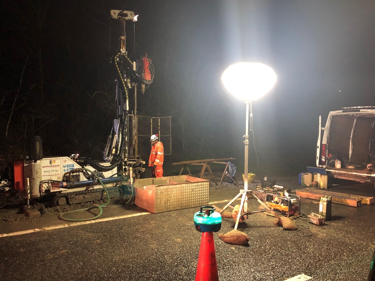
Caption: the Highways England team monitors ground conditions on the A12
There will be overnight road closures from 8pm to 6am on the A12 to allow the initial survey phases to be carried out, as follows:
- Junctions 22 to 19 on the A12 westbound until Friday 13 March;
- Junctions 23 to 25 on the A12 eastbound from Monday 16 March to Friday 3 April, and;
- Junctions 25 to 22 on the A12 westbound from Monday 6 April to Friday 1 May.
Further surveys will run until the end of August. Details of the road closures and diversion routes are at www.highwaysengland.co.uk/A12, and live traffic information can be found at www.trafficengland.com or on Twitter @HighwaysEAST. Drivers should plan ahead and allow more time for their journeys.
Highways England’s preferred route for the western section between junctions 19 and 23 has been confirmed, but there are a number of possible route options for the eastern section between junctions 23 and 25, depending on whether a proposed housing development at Marks Tey gets the go-ahead.
Last year Highways England ran a public consultation on four extra route options that may be needed, and 822 replies were received. Once there is a clear decision on whether the garden community goes ahead, Highways England will make a further preferred route announcement on the A12 between junctions 23 and 25 to reflect that planning decision and feedback from its public consultations.
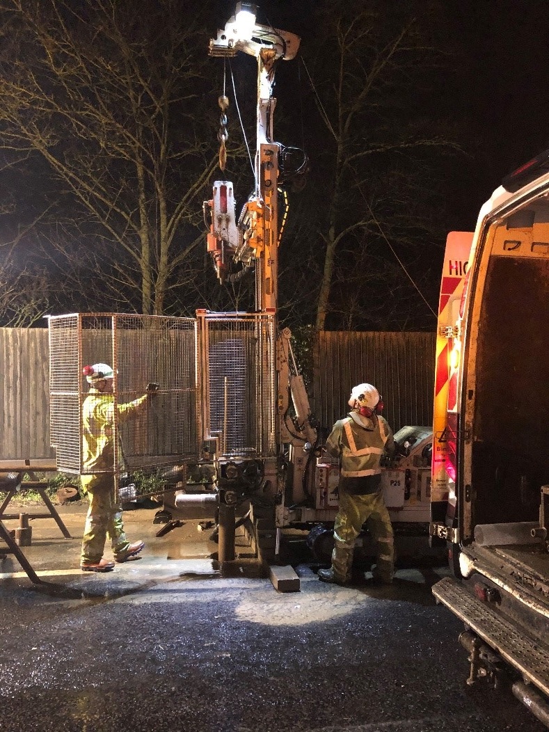
Caption: ground investigation work taking place on the A12
The first phase of ground investigation and surveys includes a comprehensive and complex schedule of tests in more than 800 locations, which includes over 190 boreholes, some of which will be up to 40 metres deep, around 230 trial pits, over 400 carriageway cores and archaeological geophysical surveys. The initial phase of tests will likely carry on until the end of April. Further phases are then likely to continue until August.
Works are also being carried out between junctions 23 and 25, with surveys covering a variety of route options as this section of the A12 improvement has yet to be finalised. Work taking place here includes environmental surveys, road surface and drainage investigations, and assessing where ground materials could be taken from for use in the project.
Box - Geology across the route
The ground conditions vary significantly along the length of the proposed A12 Chelmsford to A120 widening route.
The rock layers of the route will give geological and archaeological snapshots dating the way back to 55 million years ago.
The various rock layers are likely to include the youngest deposits (less than 2.6 million years old). They rest on older deposits or rocks known as bedrock. The younger layers are likely to have alluvium (a deposit of clay, silt, and sand left by flowing floodwater); river terrace deposits (sand and gravel); head deposits (fragments material which have weathered and then have moved downslope); brickearth (deposits from the Pleistocene geological period); Lowestoft Formation (soils left behind from a glacier); and sediments laid down by water from ice sheets and glaciers overlying the London Clay Formation (a marine geological layer from the early Eocene period).
Archaeological finds are expected to cover all of human history, with the area particularly active during the Roman and Viking invasions of Britain.